Biophysical Landscapes |
|
  |
|
| Ecozones
and Ecoregions of Ontario |
Rowe's forest regions |
|
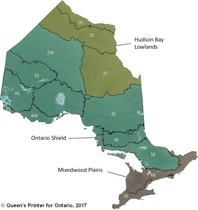
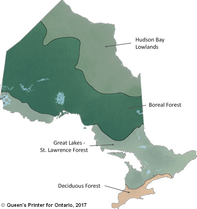
Biophysical landscapes are driven by climate, geology, soil and vegetation. Ontario’s three ecozones, the Hudson Bay Lowlands, Ontario Shield and Mixedwood Plains are defined by their bedrock and mineral composition. Ecozones can be further divided into ecoregions based on regional climatic regimes. The Province also uses land cover class area and forest regions to subdivide Ontario geographically. Each forest region is characterized by its climate, forest ecosystems and wildlife species. Most of Ontario’s settled landscapes are situated within the Great Lakes and Deciduous forest regions. |
|
|
Example Projects Delineating conservation areas on the Oak Ridges Moraine using a systematic conservation planning approach Niagara Escarpment: Forest Change Over Time |
|
Hydrological Landscapes |
|
 |
|
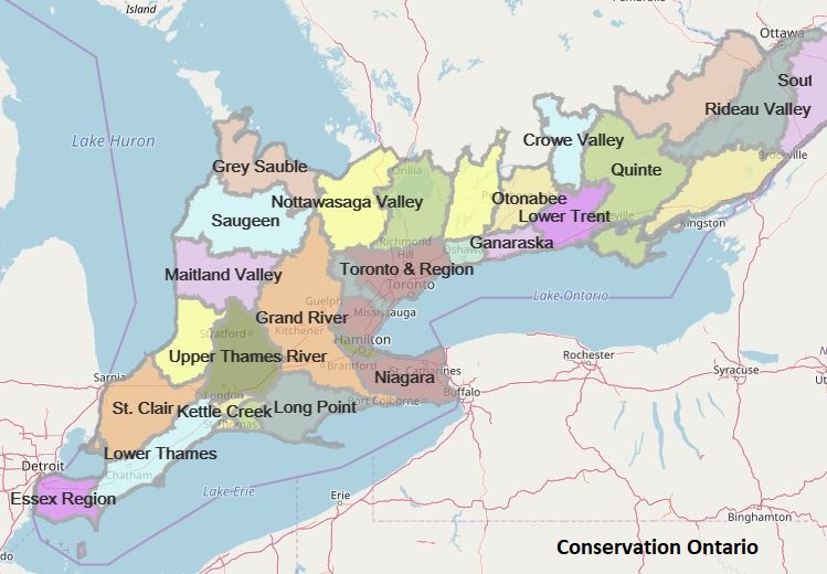
The fundamental structure of a hydrological landscape is an upland separated by a lowland by a steeper slope. Hydrological landscapes are also characterized based on climate and geology. Hydrological landscapes consist of watersheds, riparian areas, valleys and a hydrologic system of surface runoff, ground-water flow, and interaction with atmospheric water (Winter 2001). In Ontario, there are 36 Conservation Authorities who work with municipalities, the Province and other stakeholders to protect and restore the watersheds and surrounding ecosystems. |
|
|
Example Project Lake Simcoe Watershed Natural Cover Monitoring | |
Socio-Ecological Landscapes |
|
| Settlements
are defined as all developed
lands in urban and rural settings i.e. residential, recreational,
commercial,
production, transportation and industrial lands (IPCC 2006).
Some
examples of settlements include land along streets, in public and
private
gardens, in golf courses, athletic fields and in parks. Humans alter biophysical and hydrological landscapes making socio-ecology the main driver of settled landscapes. Settled landscapes are where human and environmental needs overlap and co-exist, and where conservation of biodiversity, ecosystems and species is as important as ensuring the sustainable flow of ecological goods and services to our communities. Within these landscapes, the urban core, suburban, peri-urban, ex-urban and rural areas can be distinguished. |
|
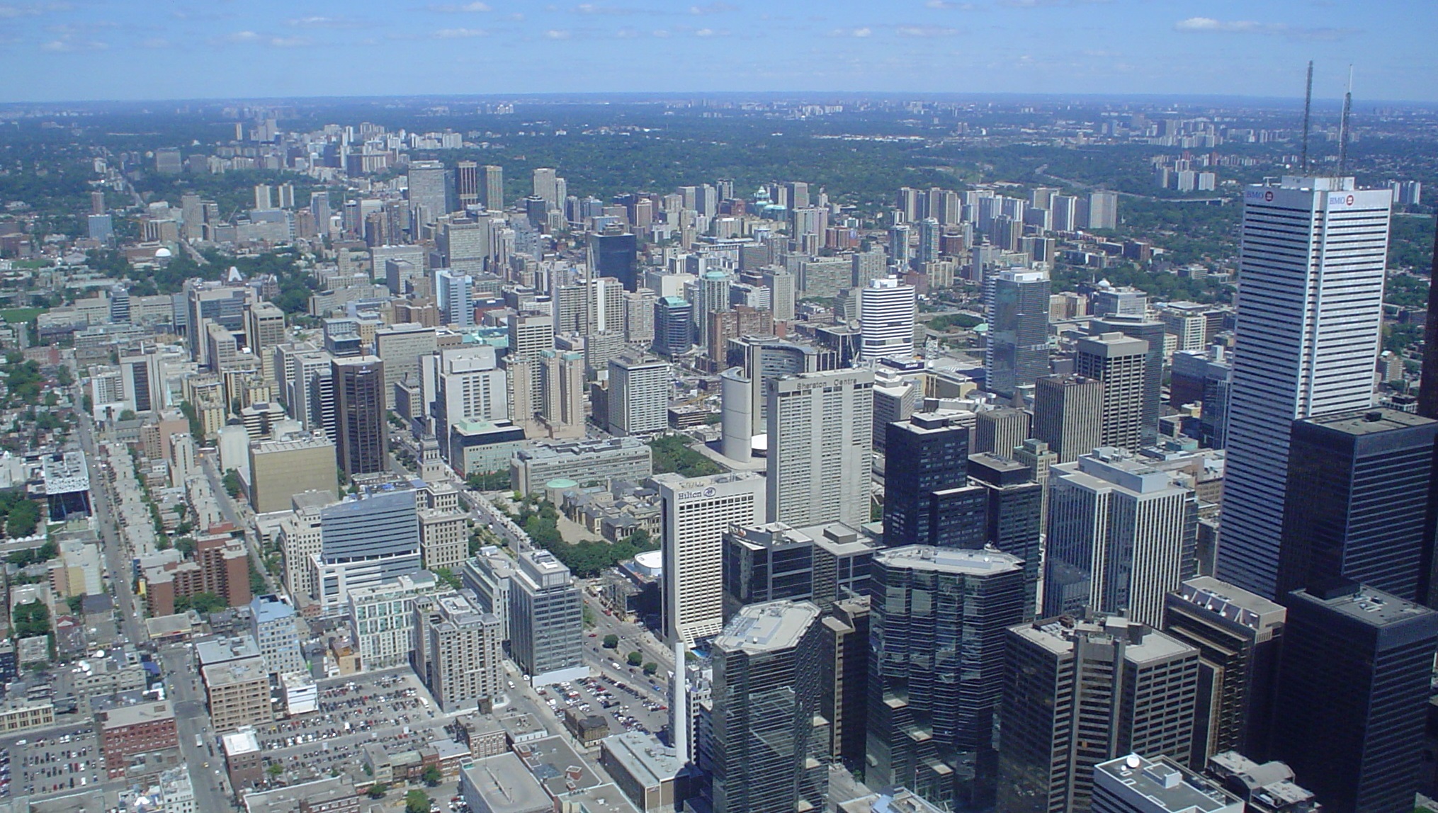
| Urban Core Developed region of a town or city, with high population density and infrastructure of built environment (e.g., downtown Toronto). |
 |
| Suburbia Residential area on the outskirts of a town or city. Suburban areas make up the largest component of urban land use (e.g., commuter area like Whitby). |
|
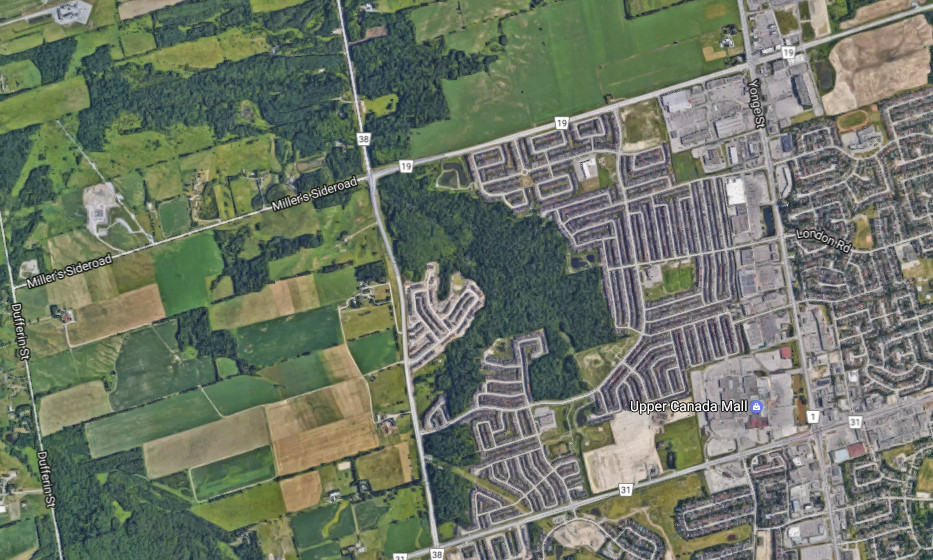
| Peri-urban Transition zone between urban and rural areas, that frequently extends 100km beyond city limits (e.g., most of Southern Ontario). Peri-urban areas have a range of uses including agriculture, water catchments, forestry, mineral extraction, and tourism and recreation. |
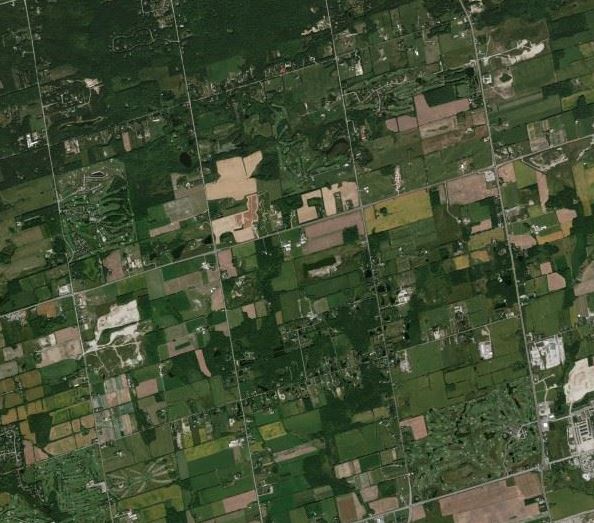 |
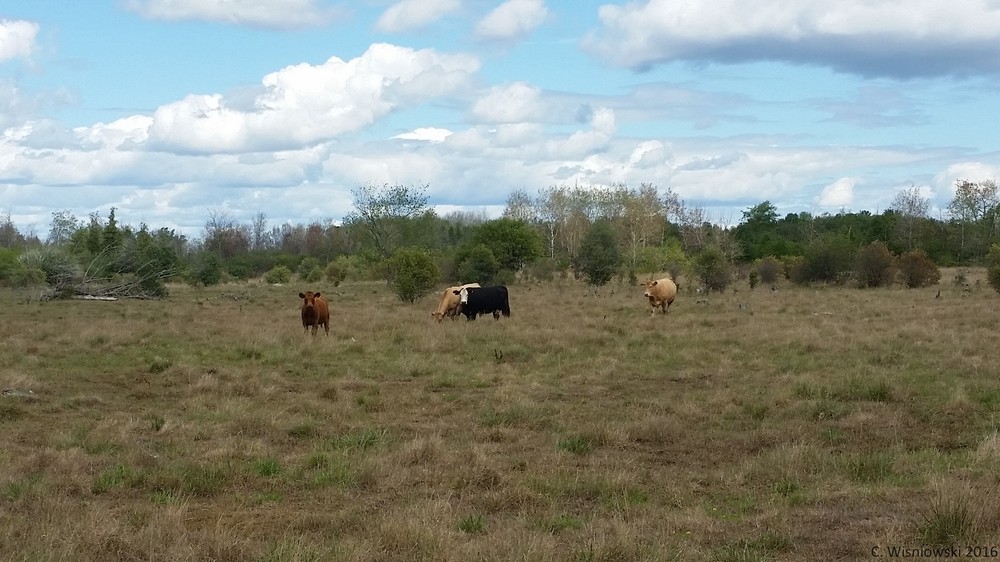
| Rural/Working Region located outside of towns and cities, with low population density and settlements (e.g., countryside). These areas are often farming and agricultural areas. |
 |
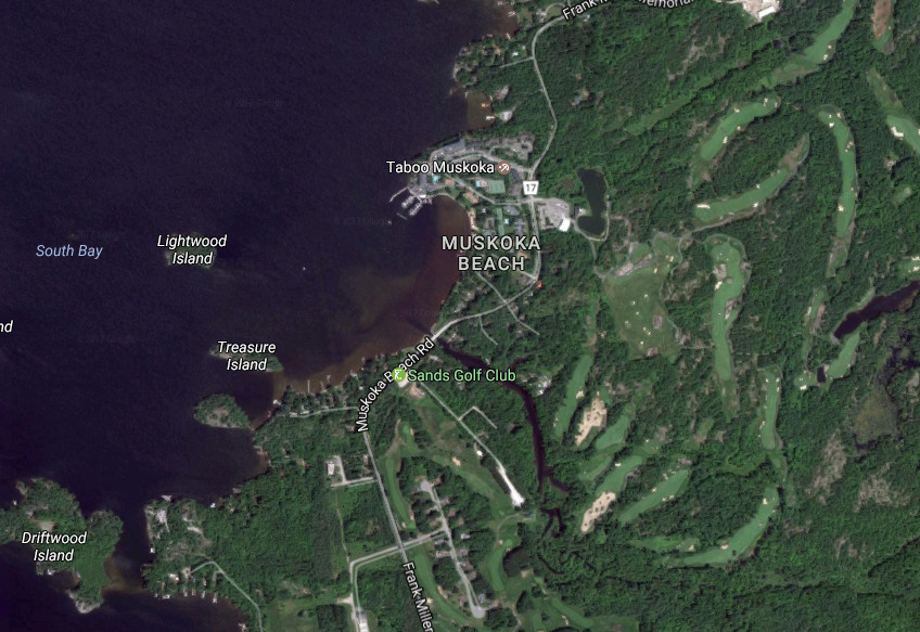
| Ex-urban Communities outside a city and its suburbs, inhabited chiefly by prosperous families (e.g., cottage country, estates). |
 |
| Example Projects Designing natural heritage systems in southern Ontario using a systematic conservation planning approach Predictive Vegetation and Species Distribution Modeling Pre-settlement Vegetation Modeling & Mapping Successful approaches for landowner contact and partnership: Natural cover monitoring for the Lake Simcoe watershed | |