Pre-Settlement Landscape and Vegetation Modeling and Mapping
“If we are serious about restoring ecosystem health and ecological integrity, then we must first know what the land was like to begin with.”
Aldo Leopold, American Ecologist
Have you ever wondered what southern Ontario's landscape looked like before European settlement? What did vegetation look like two centuries ago before farms were established, and before our cities, towns, subdivisions, schoolyards, factories, and roads were built?
What was the structure and spatial extent of forests prior to land clearing? How much natural vegetation cover was lost, and from where on the landscape? Do today's parks, protected areas, conservation lands, ravines, remnant forests, woodlots, wetlands, and grasslands resemble the historic vegetation of two centuries ago?
Using statistical modeling and prediction techniques, historical information is converted into maps of pre-settlement vegetation and landscape condition. These maps can support conservation efforts, landscape planning, ecological restoration, and natural resource management.
The process draws on information from old land surveyors' records, historical maps, documents, and botanical records to better understand the past and help shape future decisions.
Areas Modelled and Mapped in Ontario
Click any thumbnail to open the full map image.
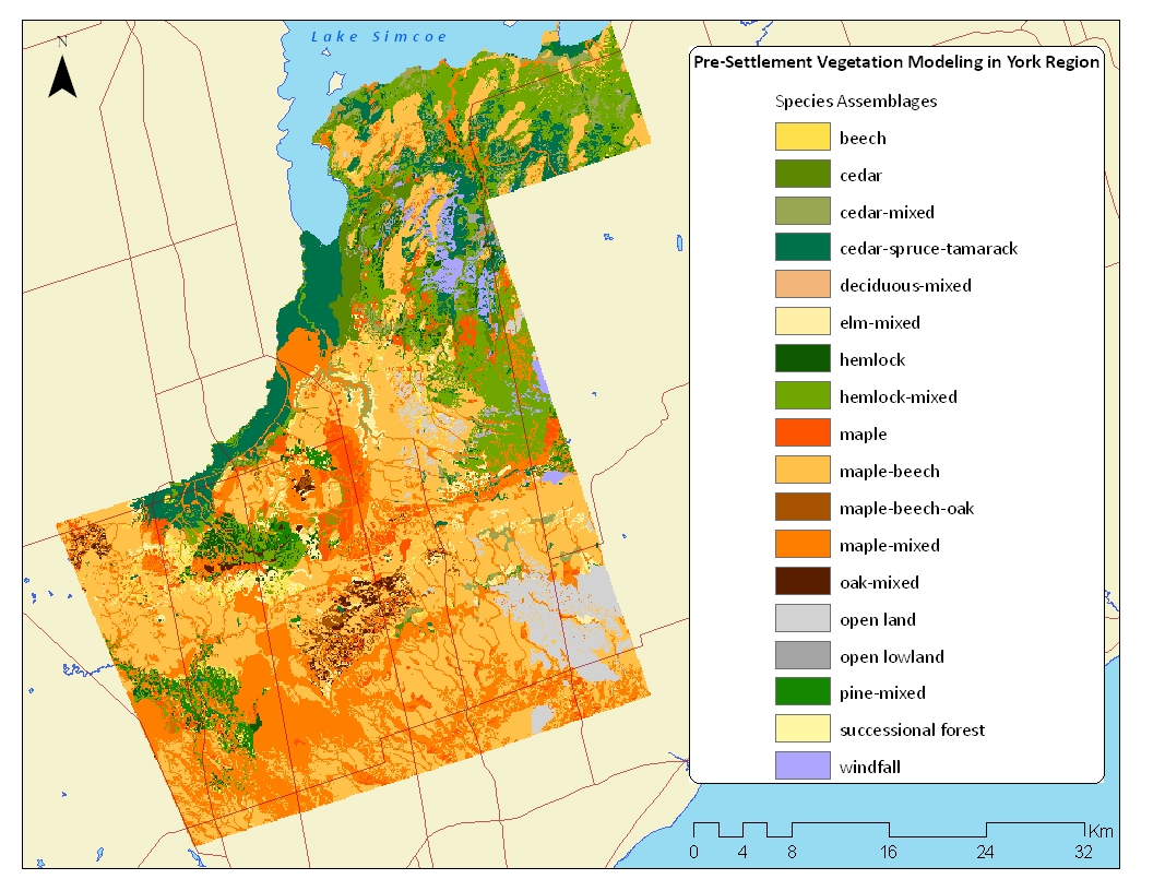
York Region
Historic vegetation mapping for York Region and surrounding landscape context.
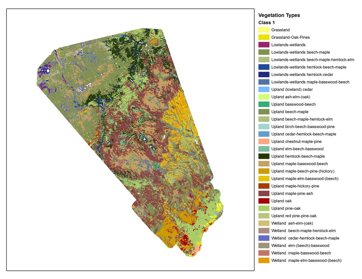
Peel Region
Pre-settlement landscape and vegetation patterns for Peel Region.
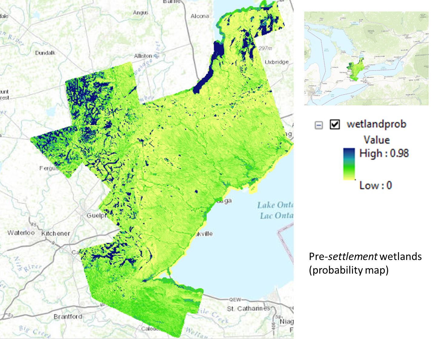
Greater Toronto Area
Regional mapping for the GTA, including broader vegetation and wetland patterns.
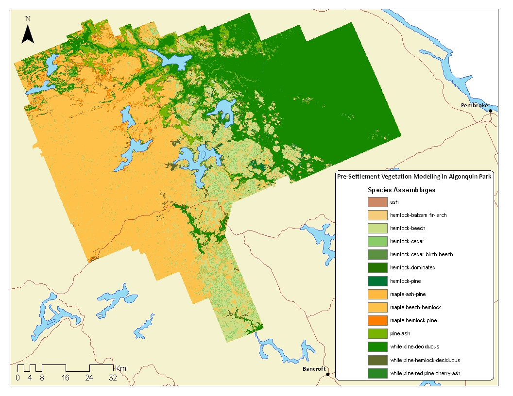
Algonquin Park
Historic landscape interpretation and mapped vegetation patterns for Algonquin Park.
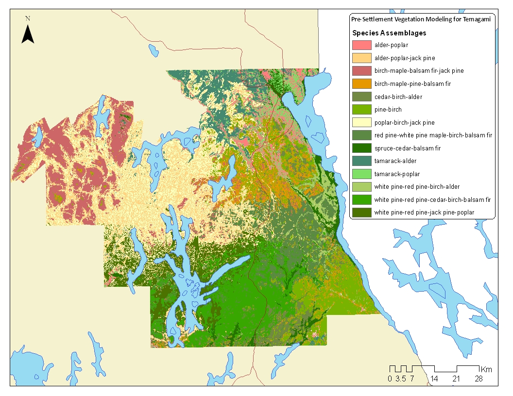
Temagami Provincial Park
Temagami Provincial Park mapping developed by Puric-Mladenovic and Pinto (2005).
Hamilton Area
Related mapping focused on historic distribution patterns in the Hamilton area.
Other Maps and Documents
Version 1 Mapping Package
Pre-settlement vegetation mapping for the Golden Horseshoe — Version 1 maps (2010)
York Region Report
Brochure and Glossy
Additional Reports
Presentations
- Historic Forest Cover Vision for the Future: York Region. Puric-Mladenovic, D. (2004)
- Reclaiming the Past to Inform the Future. Puric-Mladenovic, D. (2010), Latornell Conservation Symposium
- Team Members and Partners
Referencing this Document
When referencing a map, please indicate which map was used and reference it as follows:
Puric-Mladenovic, D. 2011. (Product). Pre-settlement Vegetation Mapping for the Greater Toronto Area, including the Regions of Hamilton, Halton, Peel and York and the Credit Valley Watershed. Ontario Ministry of Natural Resources. Southern Science and Information Section. Peterborough, Ontario. January 2011.
When referencing the document itself and not a specific data product, simply exclude the product title from the reference above.
Contact
Danijela Puric-Mladenovic
Profile and project information