VSP Home
Project Home
About the Watershed
Landowner's Page
About the Team
Results
FAQ
Gallery
Contact Us
Frequently Asked Questions (FAQs)
1. What is the purpose of the project?
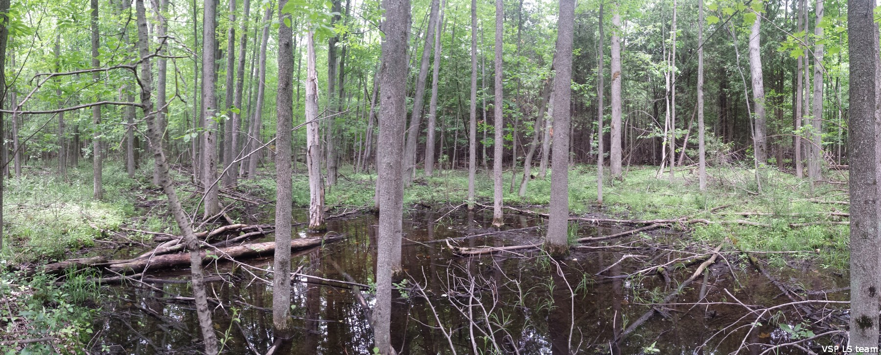
By monitoring the natural vegetation in the Lake Simcoe watershed, we can assess the state of biodiversity and quality of natural cover, as well as detect and monitor changes in natural vegetation (due to invasive species impacts, climate change, land use and development practices, natural cover fragmentations, and other presently unforeseen factors). There is currently no monitoring program for the land-based ecosystems in the watershed, and as a result very little site-level vegetation information exists for the area. This project will help establish a baseline understanding of the condition and biodiversity of natural cover, which is necessary for detecting and forecasting any future changes and impacts. The monitoring information is also a critical component of adaptive management and strategic landscape planning, which ensures that natural cover biodiversity and functions are maintained, protected and enhanced.
2. Why do you need to collect this information now?
The Lake Simcoe Protection Plan (LSPP) was finalized in 2009. This plan to protect the lake and its watershed includes a monitoring component for terrestrial features. This project will help to inform and report on many of the requirements of the plan so that we can set up a regular monitoring program for the watershed.
3. What kind of data are you collecting?
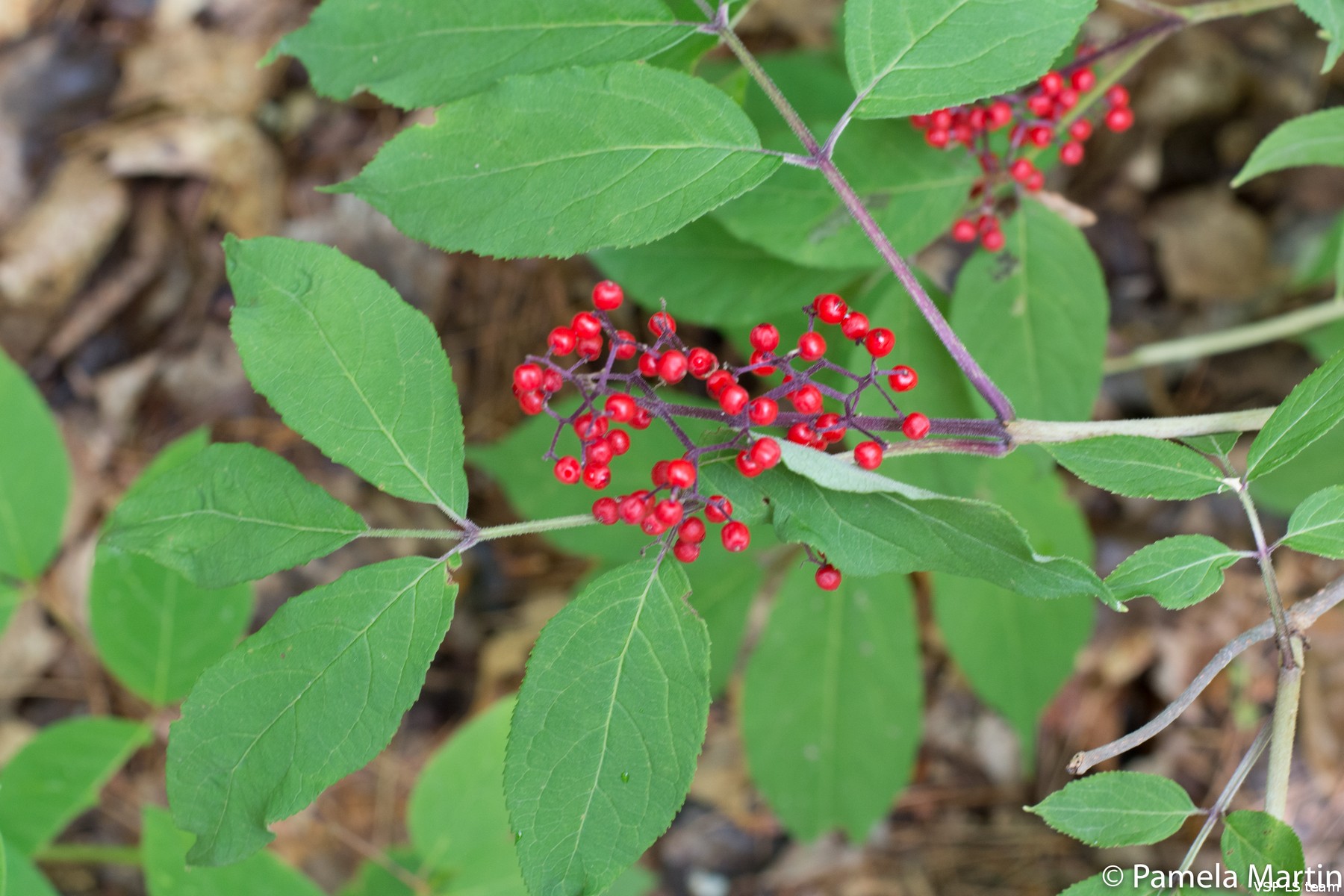
We are collecting information on plant species diversity and abundance, the structure of the natural cover, wildlife species observed, soil type and moisture content, forest regeneration, and the amount of dead wood. This project will use the Vegetation Sampling Protocol (VSP) that was developed by the MNR and the Faculty of Forestry, University of Toronto. More information on the VSP can be found on this UofT website.
4. Why do you need to sample on private property?
Natural cover occurs across a range of environments and vegetation communities that do not follow property and ownership boundaries. In the Lake Simcoe watershed the majority of land (over 80%), and thus natural cover, is privately owned. For this reason, if we are to get an accurate and complete picture about the natural cover, sampling across both public and private land is necessary.
5. How do you choose the sampling plots?
The sampling locations were selected based on a rigorous sampling design that captures the diversity of natural cover types and environmental conditions in the Lake Simcoe watershed. The sampling design for the watershed is part of the larger VSP sampling grid for southern / settled Ontario. The VSP sampling grid is systematic at the watershed level, from which a set of random locations were selected as actual sampling plots.
6. How many plots are involved in this study?
The
project has identified about 283 plots for the sub-areas of the Lake
Simcoe watershed involved in this study, of which one to a maximum of
15 are identified on a single private property or land parcel.
7. Will the data collection physically change or impact my property?
No. The data collection will not change or impact the vegetation or anything else on your property. A survey team of two to four people will enter on foot and the crew takes care not to damage any part of the property. The vegetation inventories are done by observation and nothing will be removed from your property. The only physical alteration to your property is a small auger hole (diameter approximately 1.5 inches or 4 cm) that will be made so that we can measure soil properties (texture and drainage). This hole will be filled after the soil sampling is finished.
On properties that will be resampled in the future, a ground-level marker (similar to photos below) may be left to mark the sampling plot, if permission is granted by the landowner. These stakes will be driven fully into the ground and will be searched out using a metal detector or other means. The stakes in the photos below, left partially above ground are to be driven deep into the ground at the end of the field season.
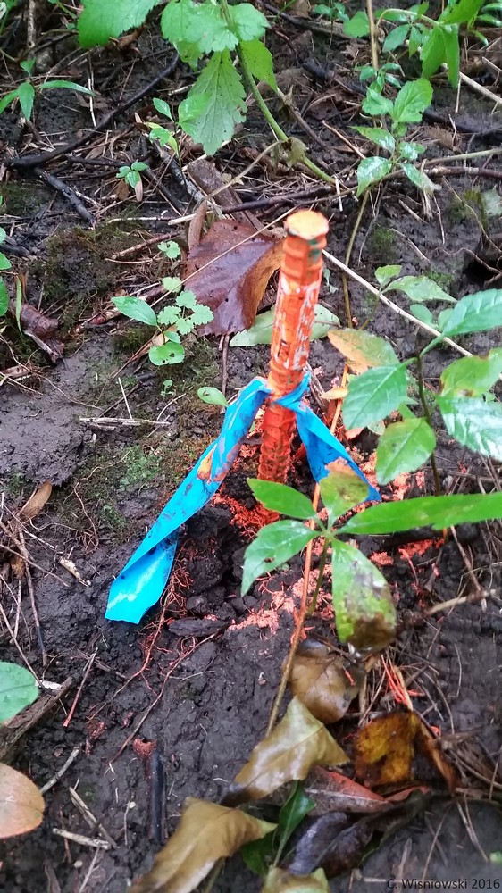
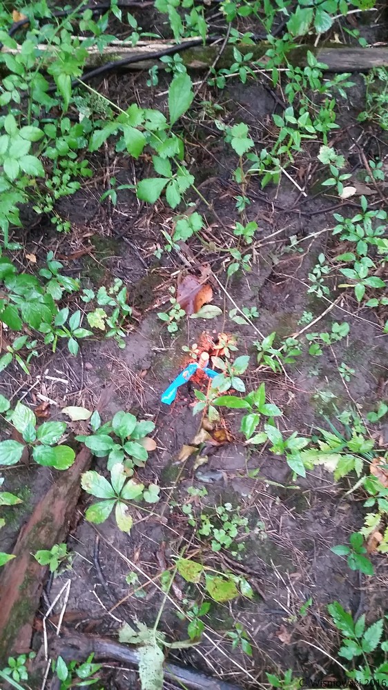
Above Images: Examples of survey stake used for future re-sampling (2016)
8. Can I refuse permission to participate in this project?
Yes. The choice to participate is completely up to you. We will not enter your property without your permission to do so.
9. Will information about my property be released to the public?
No. Specific information on each property will be combined with data from across the watershed and generalized over the larger area. Specific properties will not be mentioned to protect landowner privacy and all publicly released statistics will be general.
10. Can landowners have access to the data you collect?
Yes. The results of this study will be freely shared with the land owners as per their request. This may take some time after the completion of the inventories as the data will need to be analyzed. Individual survey results from your property can also be provided to you on request and will typically be available in the Fall or Winter following sampling. Please find here example of the landowner data reports.
Click on the thumbnail to enlarge the image.

11.
As a private
landowner what are the
benefits to me?
The specific plot information gathered on your property could assist you in the planning and management of your property by giving you information about what plants, animals and soil types you have on your land. For example, tree measurements from your property could contribute to your forest management plan. In addition, you will be contributing to a greater understanding of the Lake Simcoe watershed, its health, and an understanding of how the natural cover changes over time. This information will help inform better policies and management in the watershed, and your participation provides the opportunity for your voice to be heard in this process.
12. What happens if you find a rare species on my property?
This study is for monitoring purposes only, no actions will take place, and no restrictions will be placed on your property as a result of your participation in this study.
13. Will this project affect how I use my property?
No, the purpose of this project is to monitor and collect accurate information about natural cover in the watershed and how it is changing over time. It is not connected to any regulatory mechanisms that control land use.
14. Can I join the field crews during field work?
Yes, you are welcome to join the field crew on your property for any part, or the duration, of sampling.
15. When will fieldwork be occurring?
You will be notified if sampling is to occur on your property. However, specific dates when your property would be visited can be requested.
16. How long does it take to sample a plot?
Once the two- to four-person crew has arrived at the plot it takes between 1-3 hours to gather all of the information we need. The exact time spent at each plot will depend on the walking distance required as well as the complexity of vegetation at the site.
17. How many visits to each plot are required?
One visit should be all that is required, however a second follow-up visit may be necessary depending on the site and weather conditions. After this summer’s initial sampling visit, the plot on your property may be sampled as part of a long-term monitoring program every 5-10 years. Should this happen, you will be notified of any future visits a few months before the next sampling season, and we will ask for renewed permission to access your property. We will ask for permission to enter your property before every sampling season, and you may cancel your involvement in the project at any point.
18. Who is collecting the data?
A qualified and specially-trained field crew has been hired by the University of Toronto’s Faculty of Forestry to conduct this research project. This crew is led by Dr. Danijela Puric-Mladenovic, and includes some Master of Forest Conservation interns, who will use a portion of the sampling data for their graduate paper / research study.
19. Is this project related to other projects in Ontario?
Yes. In 2011 and 2012, a similar sampling effort was undertaken within the Niagara Escarpment Plan Area when about 110 plots were sampled. In addition, broad scale inventories utilizing the VSP protocol have been conducted in other areas of the province. For example, in Eastern Ontario about 1500 plots were sampled on both private and public lands; in the northern Bruce Peninsula, about 600 plots were sampled by Parks Canada and the Ontario Ministry of Natural Resources and Forestry; and over 1000 plots on public and private lands have been sampled along The Trent Severn Waterway. VSP has also been used by the Parks Canada in the Rouge Park (2015, 2016), City of Kitchener (2015, 2016) and the City of Guelph (2016) for unique monitoring purposes. Please click here for more information regarding other VSP Projects.
20. Who is paying for the project?
This research project is funded by the province of
Ontario as
a part of the Lake Simcoe Protection Plan.
21. Where can I get more information?
We value your input, please feel free to contact us with any questions, concerns, or comments about the project.
Contact Information
- VSP E-Mail: vspmonitoring.forestry@utoronto.ca