Canada's Urban Forestry Footprint - time step 2018-19
Mapping the extent and intensity of urban forestry activities in 2018/19
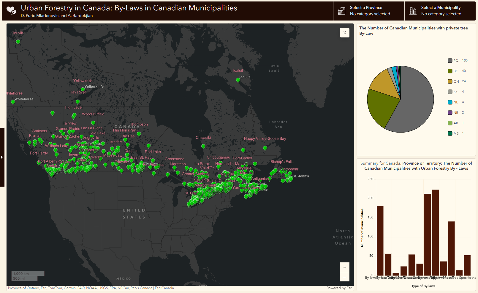
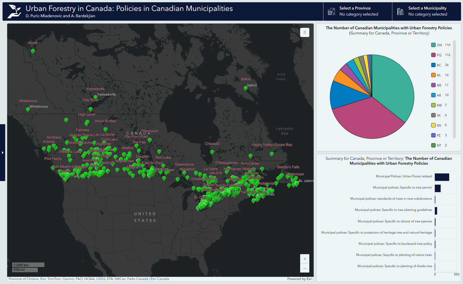
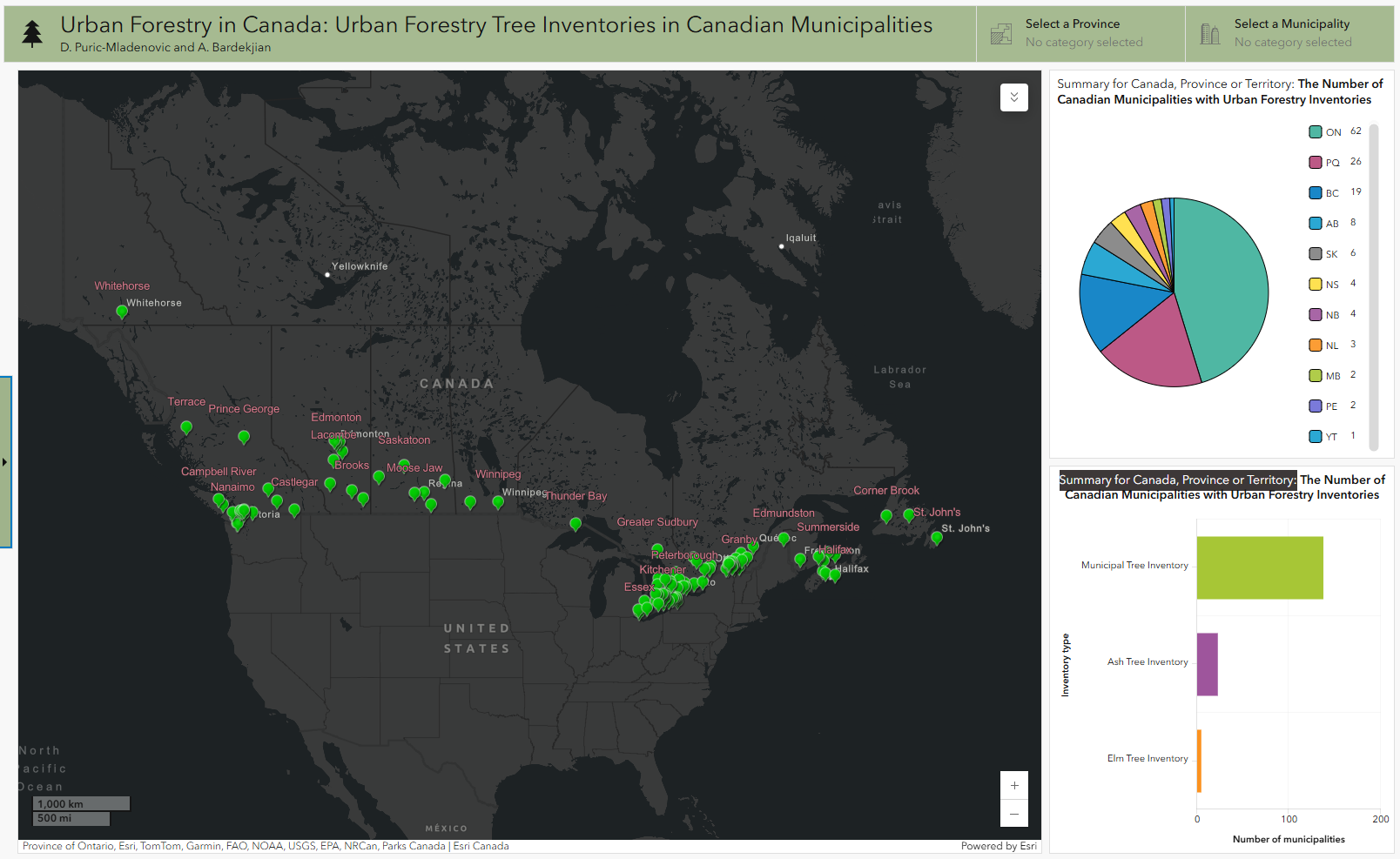
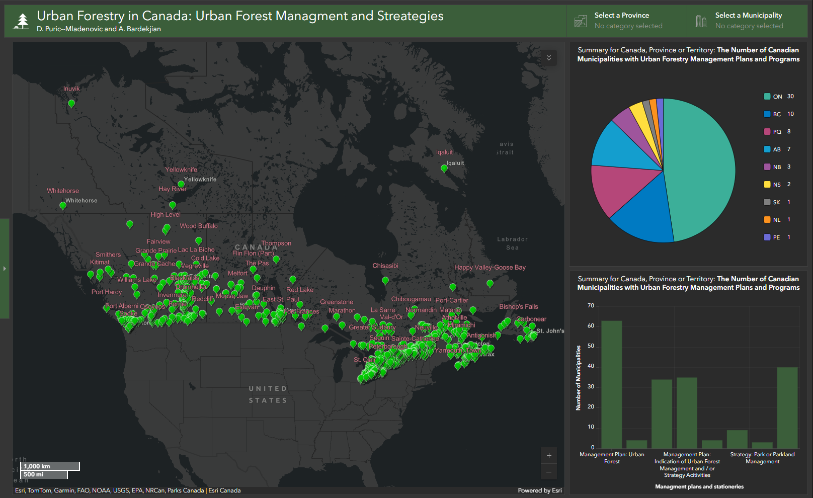
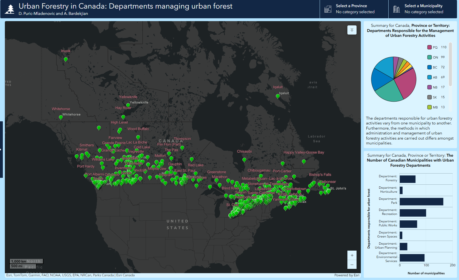
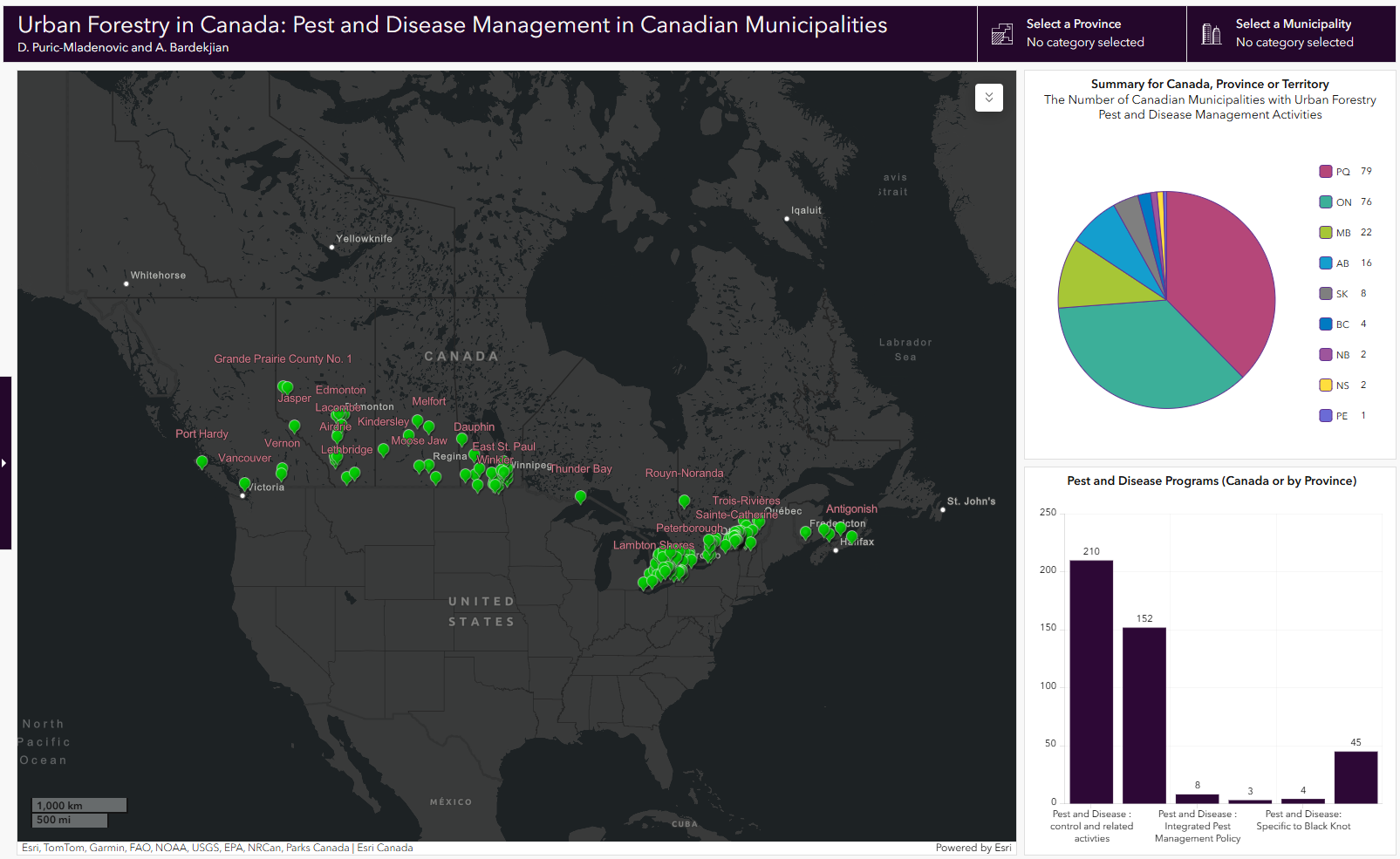
Interactive MapsCollected information on urban forestry and related stewardship, policy and management activities is spatially integrated into interactive maps. (click on an image to acess the map) | |
|
Reference Forests in Settled & Urban Landscapes applied science and research lab. Daniels Faculty, University of Toronto. John H. Daniels Faculty of Architecture, Landscape and Design, University of Toronto, and Tree Canada. [Dashboard],
ArcGIS Online. https://www.arcgis.com/apps/dashboards/21acf59a306d41dd862c4e6ba25a0da0 | Tips The map has different layers of information. You can turn on/off layers by using the avaible check boxes.. How can I find a municipality on maps? |
|
|
|
|
|
|
Home | Interactive Maps | Contact
Updated February 2025