Predicted Total Forest Biomass for Bruce Peninsula (t/ha) - biomass estimates based on Jenkins et al., 2003 Allometric Formulas
 |
|  |
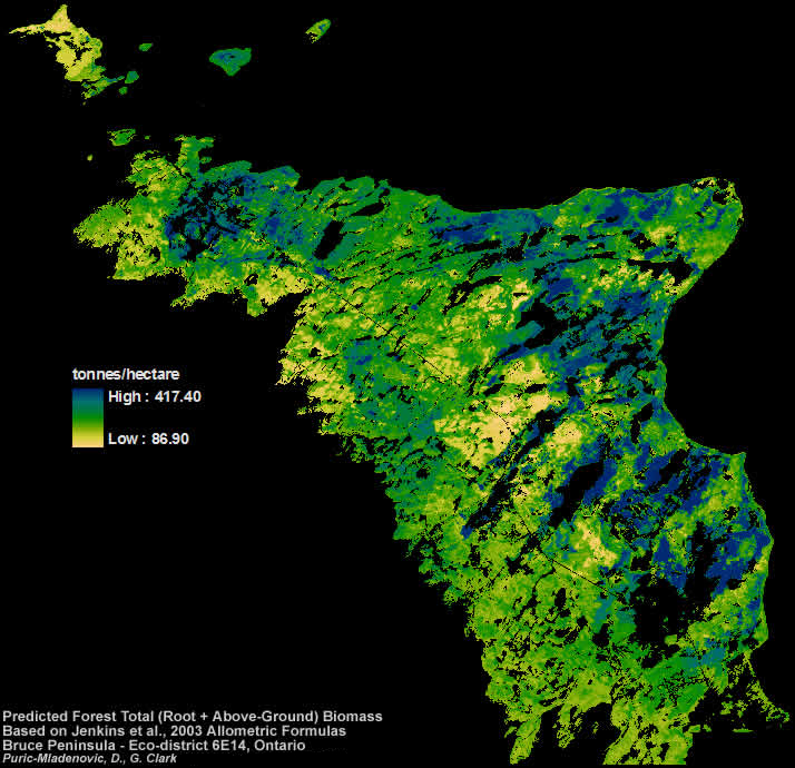
| Total (above and below ground) biomass estimates for the Bruce Peninsula area created using the Jenkins et al., 2003 allometric formulas. Estimates of biomass for this grid are presented in tonnes/hectare. This grid was created by adding predicted above-ground biomass and predicted root biomass together.
Mapped modelling results can be used to inform and support various aspects of landscape conservation, management and planning in the area. Specifically, the mappings can be used to support future natural heritage systems planning, biodiversity conservation, and species at risk habitat protection initiatives in this area. This data may also be useful for carbon sequestration models or in climate analysis work.
Through partnerships with practitioners, a large volume of geo-referenced vegetation data was collected during the summers 2005-2007. Thie field collected tree measurements along with other spatial layers (e.g., digital elevation model and derivatives, remote sensing imagery - Landsat and Quickbird, etc) were used to develop statistical models of biomass. The models were extrapolated and mapped across the entire study area.